
Our landscapes today are peppered with monuments such as megalithic tombs, castles, churches and period houses, whilst other important relicts such as old roads, remain invisible and forgotten. Despite once being an essential part of our built, social and commercial heritage, they remain unseen even to those who live close to them. Once at the centre of communication and business, many old roads are out of sight and mind, unfashionable in today’s tourist driven heritage economy. Further indication, perhaps, of our landscape amnesia.
Most ancient roads and routeways have been erased by time, but occasionally Bronze Age trackways, or tohars, are uncovered in bogs, and an Early Medieval pilgrim routeway from Tara to Galway still snakes along raised ridges of glacial eskers near the River Shannon at Clonmacnoise. From the 18th Century onwards, many roads were abandoned as a modernising economy required new road networks to transport goods and services more economically and efficiently between growing towns and cities. Many of these roads endure today as unintentional linear natural heritage sites abundant with wildlife.

By overlaying satellite imagery with old maps, we can determine where some old roads once traversed valleys, hills and river fording points. Usually constructed in straight lines to assist horses pull lighter coaches, some old road sections still form part of our current network, whilst discarded segments have become farm lanes and tracks through bogs. As the economy expanded heavier wagons were needed to transport greater loads, and new roads were designed to flatten gradients and go around drumlins, rather than over them as before.

Using a 1732 map of the Principal Roads of Ireland and Google Earth I easily made out the straight line of the old Garrison to Belleek Road. The 300-year-old road ran about 500m to the east of the current road which was built to replace it in the mid 1800’s. Intriguingly, the 1860 Ordnance Survey map also indicated a cluster of twelve neatly spaced buildings near the road in Aghamuldowney townland, a mile north of Garrison. Marked as Newtown, they were connected via a short lane to the old road and nearby school. The earlier 1830 Ordnance Survey map showed a smaller but unnamed cluster of buildings so the appellation of Newtown came about between 1830 and 1860. Initial conversations with local people revealed that few knew about the old road, and that no one had heard of Newtown. My planned exploratory walk was shaping up nicely.
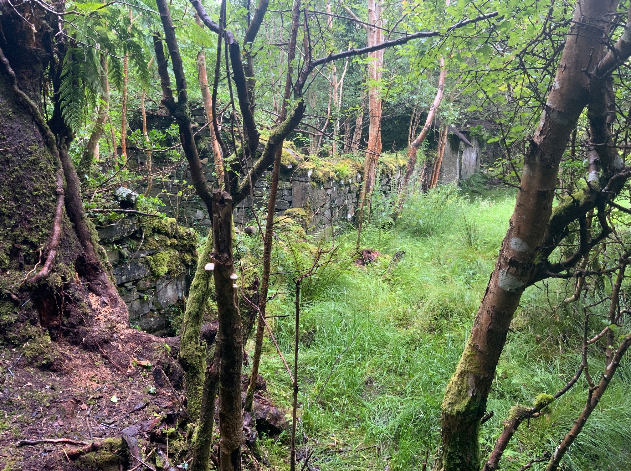
Matching information from a two-dimensional map to a location on the ground is always revealing, and so it turned out for Newtown. As I walked through the light deciduous green undergrowth of the coach road to the laneway junction leading to the houses, I was pleasantly surprised to see how clear of scrub it was. Passing the single stone gate pillar which marked the corner of the intersection, I followed the laneway along the unnamed stream to the hamlet to find the derelict stone buildings and extensive field system indicated on the maps. Then serendipity took a hand as closer inspection revealed another stone carved gate pillar, domestic pottery and agricultural machinery. Under the conifer-green gloom were horizontal lines of moss-covered banks and ditches stretching away in all directions between vertical ranks of trees. A forgotten name on an old map was revealed as a tangible place of wonder, suggestive of people who lived in this small farming community in a time of great change. But who were they?

Further desk research away from the scratchy undergrowth and relentless July rain showed that tenants and landlords came and went, some buildings collapsed, others were reused as farm outhouses, and that the last occupant resided there within living memory. The answer as to who named the place Newtown and connected it to the superhighway of its day may yet be found in papers held by the Ely Estate, the landowner at the time. The extensive system of small fields around the houses is evidence of a general landscape enclosure pattern developed by landlords in Ireland from the mid 1700’s to the mid 1800’s, with probable pre-famine origins. Once linked to an old road Newtown today is shrouded by forest, and its well-preserved and barbed wire-free bank and ditch field boundaries are preserved within a verdant place of mystery and desertion, where barking deer and screeching sparrowhawks break the silence. Roads less travelled are undoubtedly the most interesting, especially one such as this which cause us to reflect not only on the lives of those that lived along it, but also on our own forgetfulness.
“But now the sounds of population fail, no cheerful murmurs fluctuate in the gale, no busy steps the grass grown foot-way tread, for all the bloomy flush of life is fled”.
Deserted Village: Oliver Goldsmith.


Thanks to landowners, local people, Belleek historian Joe O’Loughlin, the family of the late Garrison historian Pat McGuinness and Gaby Burns for their assistance.


Leave a Reply